Join us at DMEA 2026 — See a demo of our solutions LIVE!
Join us at DMEA 2026 — See a demo of our solutions LIVE!
Join us at DMEA 2026 — See a demo of our solutions LIVE!
Join us at DMEA 2026 — See a demo of our solutions LIVE!
Join us at DMEA 2026 — See a demo of our solutions LIVE!
Join us at DMEA 2026 — See a demo of our solutions LIVE!
Join us at DMEA 2026 — See a demo of our solutions LIVE!
Join us at DMEA 2026 — See a demo of our solutions LIVE!
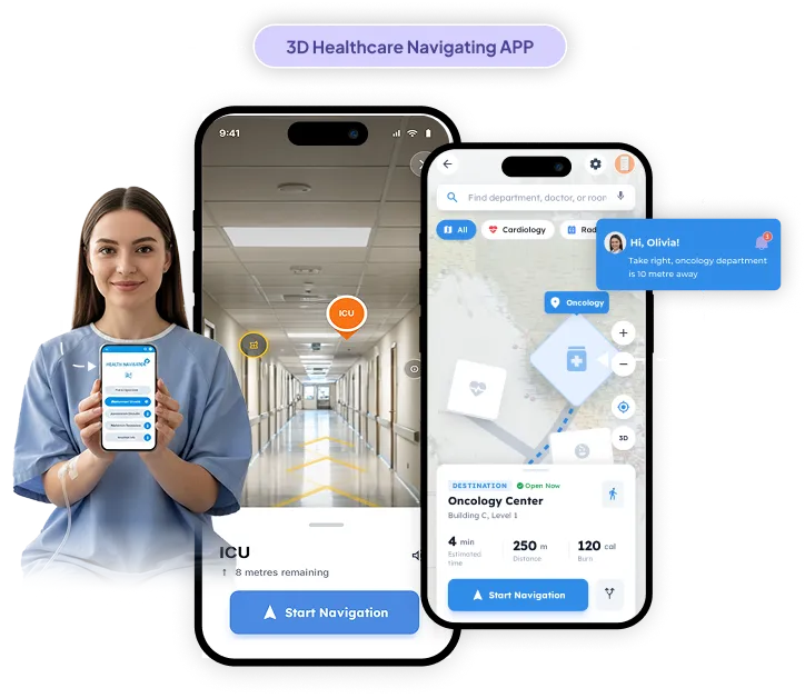
3D Indoor Navigation System for Healthcare Facilities
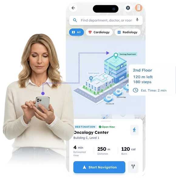
The 3d indoor navigation system platform turns static 2D healthcare maps into interactive 3D experiences that simplify navigation with precise directions, floor-level details, and clear visuals for patients, staff, and visitors.
An interactive navigation tool that helps patients reach appointments on time, assists staff in guiding visitors, and improves accessibility.
Enhancements
3D Navigation Upgrade
Smooth Rendering
Cross-Platform Support:
Floor level precision
Flexible Map Uploads
Services Delivered
In-app assessment
Real-time reporting
Standardized test scoring
Clinician management portal
Cultural image library updates
Tech Stack
MapLibre
Martin Server
iOS, Android, Web App
Project Overview:
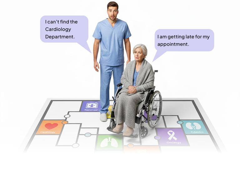
Navigating large healthcare facilities is often a source of stress for patients and visitors. Complex floor plans, multiple departments, and varying points of interest make it difficult to locate specific amenities or reach appointments on time. The client wanted a solution that would provide both visual clarity and precise guidance.
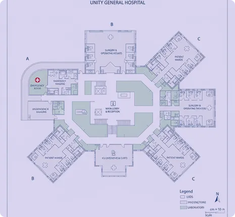
Folio3 upgraded the system by turning 2D maps into interactive 3D maps, highlighting key locations such as labs, restrooms, elevators, parking areas, and clinics. Provides step-by-step guidance for easy movement around the healthcare facility while ensuring smooth performance on all devices, providing a reliable navigation experience.
We upgraded the platform from 2D to interactive 3D, calculating accurate heights for floors, buildings, and amenities. Users can now visualize the facility in three dimensions, making navigation intuitive and less stressful.
Optimized Rendering
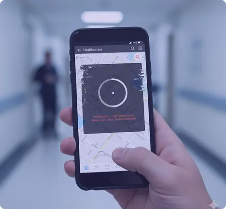
Maps are divided into MBTiles for smooth, low-memory performance, ensuring fast loading times on mobile devices without compromising detail or accuracy.
Interactive Guidance
The platform provides step-by-step directions, detailed floor-level maps, and amenities listings, helping users find restrooms, labs, clinics, and other points of interest effortlessly.
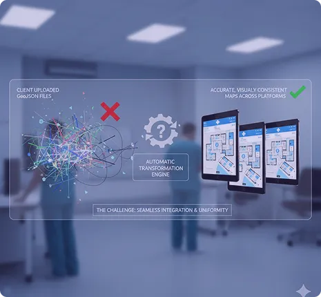
Flexible Map Integration
Clients can upload GeoJSON maps, which the system translates, applies styles to, and renders efficiently across mobile and web platforms, making updates seamless and scalable.
Enhanced patient and visitor experience Users can navigate complex healthcare facilities with confidence, reducing confusion and stress.
Improved operational efficiency Staff can assist visitors more effectively and monitor facility traffic to streamline movement and reduce congestion.
Reliable performance Optimized tile rendering ensures responsive maps on mobile and web devices, even in resource-constrained environments.
Future-ready platform The system can scale easily to accommodate larger facilities or additional areas, allowing seamless integration of new points of interest and updated floor plans.